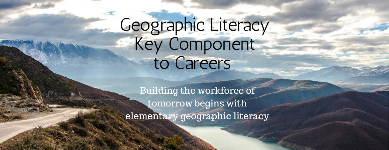
Geographic Literacy Key Component to 21st Century Careers
Developing geographic literacy (geoliteracy) in our school-age children is important for a multitude of reasons. Students who study geography develop essential workforce skills such as the ability to analyze, synthesize and interpret visual resources. They become better problem solvers and decision makers as they learn to identify patterns, notice change, and blend disciplines. Geoliterate students become the pool for important 21st century careers including those in geospatial intelligence and technologies related to remote sensing, geographic information systems (GIS), and global positioning systems (GPS).
A geographic education is a necessary part of a complete education. This is becoming more apparent as geo-spatial technologies including remote sensing and mapping tools have become critical to our economic success and governance in areas such as natural resource management, international commerce, transportation, risk management and national defense and security. As a recent report commissioned by Google points out, the demand for a trained geo-spatial workforce is far outpacing our ability to educate future workers. Source: National Council for Geographic Education
Geographic factors assume greater importance as our society and economy become more global. More and more, it is important to understand the geographic impact of why and how we fit into our world and how to apply technologies related to decision making, legislative policy, economic development, environmental stewardship, and more.
In 2013, a legislative bill was presented to Congress that would improve and expand geographic literacy among kindergarten through grade 12 students in the United States. It noted important economic and global findings about why a geoliterate citizenry is valuable in today’s workforce:
- It is estimated that the United States geospatial industry generated $73,000,000,000 in revenue last year, with 500,000 high-wage jobs and that the industry is growing at between 25–30 percent per year.
- A 2012 report by a Council on Foreign Relations task force, U.S. Education Reform and National Security, states that the lack of global awareness among United States citizens increasingly jeopardizes their ability to interact with local and global peers, or participate meaningfully in business, diplomatic, and military situations.
- We live in a changing world with multiple and evolving threats to national security, including terrorism, asymmetrical warfare, and social unrest. As the nature of the threat evolves, so do the tools, knowledge, and skills needed to respond. A 2013 National Academies report states that it is likely that qualified GIS (Geography Information Systems) and remote sensing experts are already hard to find. Long before 2030, competition and a small number of graduates will likely result in shortages in all emerging areas and in the core areas of cartography, photogrammetry, and geodesy.
While there are many traditional careers that require a solid background in geography education, such as urban planning, community and real estate development, and cartography, there are some exciting and critical-need career paths requiring a geoliterate workforce.
Remote Sensing: Remote sensing involves collecting data about objects and places on the earth’s surface from a distance. Specialists in remote sensing use various images including air and satellite to uncover information about shapes, size, elevation or composition of objects or locations. Remote sensing is used in all forms of environmental sciences including agriculture, archaeology, urban planning, water management, meteorology, and even engineering and business.
Geographic Information Systems: Geographic Information Systems (GIS) is defined as a system designed to capture, store, manipulate, analyze, manage, and present all types of spatial and geographical data. Notice the first word; the key component to this technology is geography! GIS specialists use data that is related to specific locations on the earth to problem solve and make decisions. They use geospatial software and tools that manage large sets of data and display them in a map or graphical form.
Geospatial Intelligence: The Geospatial Intelligence (GEOINT) industry integrates diverse data gathering methods to collect, process, narrow, and define strategic decisions in many sectors. It is a mashup of technology combining STEM, geography, acquisition and decision making disciplines. GEOINT specialists are critical for our responses to natural disasters, national and homeland security, trade, and other national and global issues.
Careers requiring a solid background in geoliteracy are not passe or irrelevant. Just the opposite! Jobs in the 21st century require skills that meld multiple disciplines, including geography. The value of geoliteracy increases as the world’s economies, societies, and political structures grow more global in scale. Where is the focus on geography in your classroom? Concepts, skills, and perspectives of geography can be easily integrated into just about any classroom subject or presented through a systematic approach of geography instruction. Don’t miss the opportunity to fully prepare your students for the future.
 Barb Bailey is the Director of Learning at LearningPlunge, Inc. She has a Master of Education degree and 15 years of teaching experience. Barb is committed to providing high quality educational resources for all children. Reach out to her at [email protected].